The Day Okinawa Switched Sides: How July 30, 1978 Changed Every Road Across the Islands
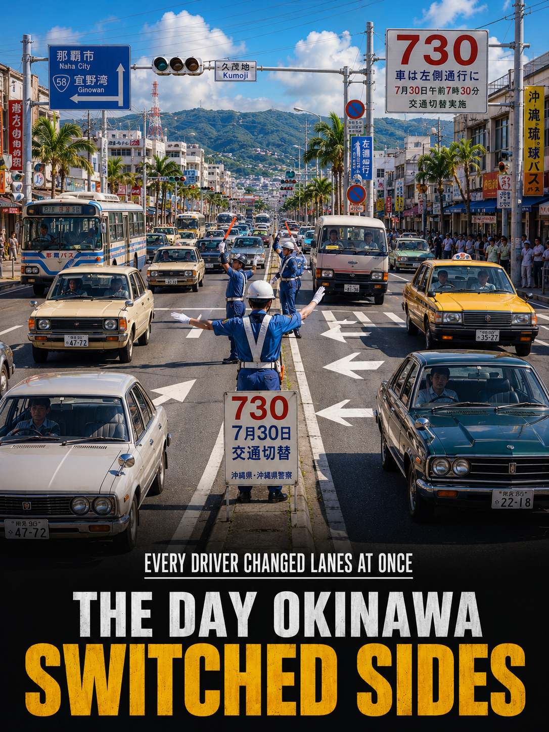
Imagine waking up one morning knowing that every road in your community would operate differently before the day was over.
For the people of Okinawa Prefecture, that extraordinary moment arrived on July 30, 1978. Known simply as “730,” the date marks one of the most remarkable transportation changes in Japan’s modern history—the day Okinawa abandoned right-hand traffic and returned to driving on the left side of the road.
It was a single date that required an entire prefecture to adapt at once.
The change was not merely about moving vehicles from one side of the street to the other. It affected traffic flow, road use, and the daily routines of people across Okinawa’s islands. From that day forward, drivers once again followed the same left-hand traffic system used throughout the rest of Japan.
The event became so significant that the numbers themselves—730—came to represent the transition.
For Okinawa, the date has remained a lasting historical reference, symbolizing a coordinated transformation that touched nearly every aspect of transportation across the prefecture.
To understand why the change mattered so much, it helps to understand Okinawa itself.
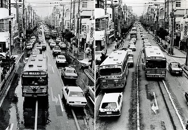
Located at the southernmost and westernmost edge of Japan, Okinawa Prefecture stretches across a vast maritime region. Although its total land area is a relatively modest 2,281 square kilometers, the prefecture extends over surrounding seas that make its overall territorial reach nearly half the combined size of Honshu, Shikoku, and Kyushu.
Rather than consisting of a single island, Okinawa is made up of three major island groups.
These are the Okinawa Islands, the Sakishima Islands, and the Daitō Islands, spread across an area measuring approximately 1,000 kilometers from east to west and 400 kilometers from north to south.
In total, the prefecture contains 160 islands, though only 49 are inhabited.
The largest and most populous is Okinawa Island, home to the prefectural capital of Naha as well as important urban centers including Okinawa, Uruma, and Urasoe. These communities became central locations in adapting to the traffic change that defined July 30, 1978.
The islands themselves are known for their subtropical environment.
Warm temperatures and abundant rainfall characterize Okinawa’s climate throughout the year, creating landscapes that differ noticeably from many other parts of Japan.
The people who inhabit these islands also reflect a rich regional identity.
Residents of the Nansei Islands, including Okinawa, the Sakishima Islands, and parts of Kagoshima Prefecture, are often collectively known as Ryukyuans. Yet despite that shared designation, each island—and often individual local communities—maintains distinct cultural traditions and customs.
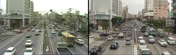
Against this unique geographic and cultural backdrop came the historic transportation shift remembered as 730.
The transition centered on one of the most fundamental rules governing road travel: which side of the road vehicles use.
Around the world, countries generally follow one of two systems.
Some use left-hand traffic (LHT), where vehicles travel on the left side of the roadway. Others operate with right-hand traffic (RHT), requiring drivers to stay on the right.
These rules influence virtually every aspect of driving.
They determine where vehicles travel, how traffic flows through intersections, and even the side on which drivers overtake slower vehicles. In countries using left-hand traffic, for example, passing another vehicle typically occurs on the right.
The terms “left-hand drive” and “right-hand drive” often create confusion.
While traffic rules describe which side of the road vehicles use, the terms referring to vehicle design indicate where the driver’s seat and steering wheel are positioned inside the automobile. The two concepts are related but not identical.
For Okinawa, the 1978 transition represented a return to left-hand traffic.
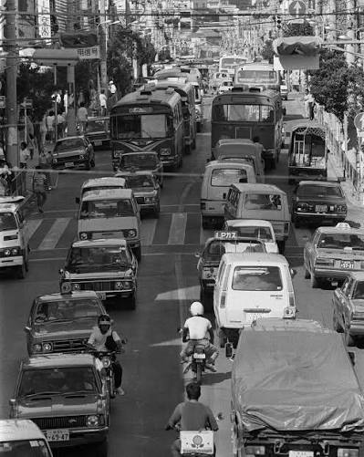
The coordinated change required motorists across the prefecture to adjust simultaneously, making it one of the most memorable transportation events in the region’s history.
More than four decades later, the numbers 730 continue to carry meaning far beyond a simple calendar date.
They recall a day when an entire prefecture altered one of the most basic habits of everyday life. Drivers who had become accustomed to one system suddenly embraced another, reshaping the experience of travel across dozens of inhabited islands.
The story of 730 also reflects Okinawa’s unique place within Japan.
Its widely scattered islands, distinctive Ryukyuan heritage, subtropical climate, and broad maritime territory make it unlike any other prefecture in the country. The transportation change of July 30, 1978, became another defining chapter in that unique history.
Today, visitors driving through the streets of Naha, Okinawa City, Uruma, or Urasoe may never realize that the roads once operated differently. Yet every journey taken on the left side of the road quietly echoes the decision made on that summer day in 1978.
For Okinawa, 730 remains more than a number. It represents a moment when an entire region changed direction together, proving that even one of society’s most familiar routines can be transformed through a single historic day.